Keywords:Camera, Camera Equipment, DFP, Dorrance Forest Preserve, LASER, Measurement, Measuring Rod, Park, Rope, String Line, Survey, Tools, Tripod
Photo Info
Dimensions1000 x 667
Original file size887 KB
Image typeJPEG
Color spacesRGB
Date taken21-Sep-16 17:50
Date modified22-Sep-16 02:04
Shooting Conditions
Camera makeCanon
Camera modelCanon EOS REBEL T2i
Focal length28 mm
Max lens aperturef/3.7
Exposure1/50 at f/3.5
FlashNot fired, compulsory mode
Exposure bias0 EV
Exposure modeAuto
Exposure prog.Normal
ISO speedISO 3200
Metering modePattern
Topographic Survey
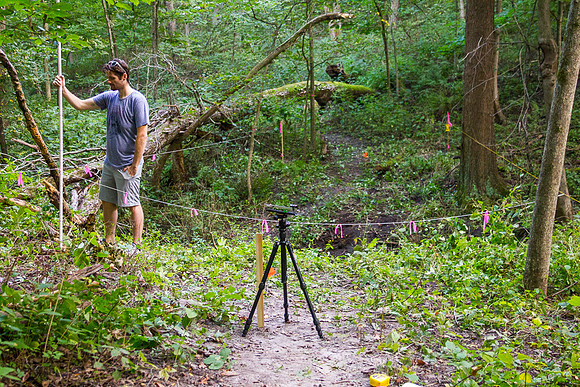
Conducting a topographic survey of the location for a +30' bridge. Using a homemade laser level and measuring rod. The grid boundary is 14'x50' and divided into 2'x2' sections (~200 total points). The parallel string lines spanning the ravine support another string which is marked at 2' intervals with flagging ribbon. This string is moved forward 2' after each row of data points are collected to create the grid.